
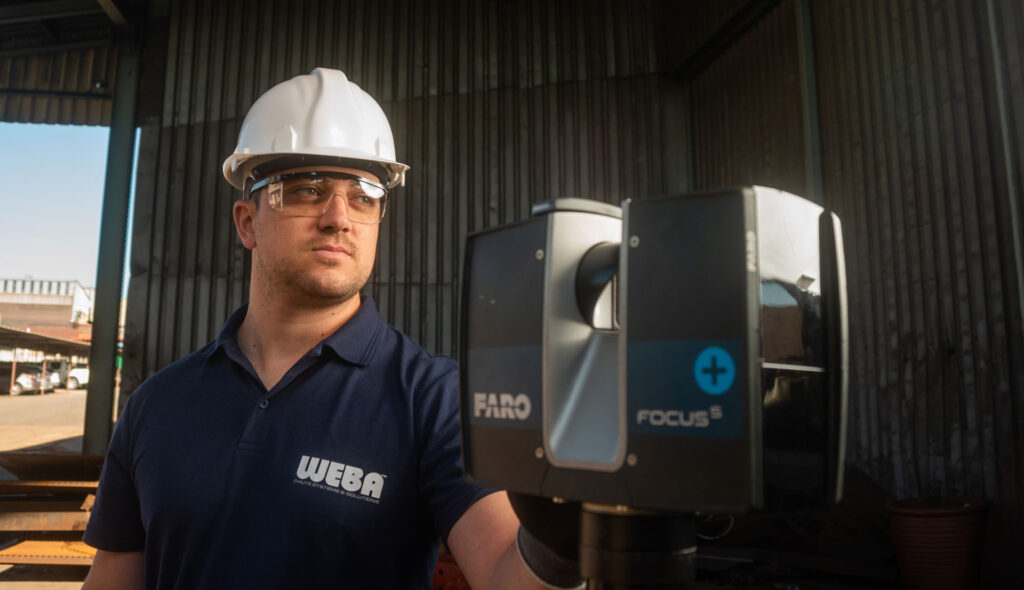
For centuries, surveying and measurement have been the foundation of construction, architecture, and engineering. From tape measures and theodolites to total stations and drones, every technological leap has aimed at one goal: representing the physical world as accurately as possible.
Yet, even today, many projects are still built on incomplete data, outdated drawings, and best-guess assumptions.
This is where Weba 3D Scan enters the picture.
Laser scanning is not just another tool in the surveyor’s kit, it represents a fundamental shift in how we understand, document, and interact with the built environment. Instead of simplifying reality into flat drawings or fragmented measurements, we capture it in its full three-dimensional complexity.
Seeing buildings as living systems, not static structures
Traditional surveys treat buildings as static objects, lines on paper, elevations, and floor plans. But real structures are dynamic. They settle, shift, age, expand, and change over time. Walls are rarely perfectly straight, floors are seldom entirely level, and original drawings often fail to reflect what actually exists on site.
With laser scanning, we don’t impose ideal geometry onto reality. We let reality speak for itself.
In minutes, millions of data points are collected, creating a precise digital replica — a “digital twin” — of the physical space. Every beam, column, roof slope, and structural deviation is captured with millimetre accuracy.
This means that decisions are no longer based on assumptions — they are grounded in truth.
Operating where traditional methods fall short
Some environments simply don’t lend themselves to conventional surveying.
Active factories, high roofs, congested plant rooms, underground spaces, mining sites, and hazardous industrial environments can make manual measurement slow, risky, or even impossible.
Weba’s laser scanning technology moves effortlessly through these challenges.
We can capture accurate data without stopping operations, shutting down production, or putting people in danger. This not only protects workers but also keeps projects moving forward without costly delays.
In many cases, what once took weeks can now be achieved in days or even hours.
From data to better decisions
The true value of laser scanning is not the scan itself — it is what you can do with the data.
Architects can design with real-world accuracy rather than theoretical approximations. Engineers can verify structural conditions before making modifications. Contractors can detect clashes between new designs and existing infrastructure before breaking ground.
For example, in a recent Wadeville workshop project, traditional roof measurements were insufficient for precise solar planning. By scanning the facility, Weba provided an exact digital model of the roof geometry. This enabled optimal solar panel placement, avoided wasted space, reduced errors, and ultimately saved the client both time and money.
That is the power of reality capture in action.
Collaboration built on clarity
One of the most underrated benefits of 3D scanning is how it improves communication.
Instead of stakeholders arguing over drawings, interpretations, or discrepancies, everyone can literally see the same 3D model of the building. Clients, architects, engineers, and contractors align around a single source of truth.
Misunderstandings decrease. Approvals speed up. Teams work more cohesively.
In an industry where coordination failures can cost millions, this shared visual understanding is invaluable.
As-built surveys: documenting reality, not intentions
Original construction plans rarely match what was actually built. Over time, renovations, modifications, and repairs further distance a structure from its original documentation.
Weba’s as-built surveys create an accurate, up-to-date digital record of existing conditions using BIM principles. These models can be used for maintenance, expansion, compliance, retrofitting, or future development.
For clients who prefer to build their own models, we deliver registered point clouds in their preferred format — giving them complete flexibility while preserving data integrity.
Preventing problems before they happen
Construction verification and clash detection are where laser scanning truly shines as a risk-management tool.
By overlaying design models onto real-world scans, discrepancies are identified early — before they turn into costly site rework, disputes, or project delays.
Potential clashes between pipes, ducts, beams, and structural elements can be resolved in the digital space rather than on the construction site.
In short: better planning today leads to fewer crises tomorrow.
A new way of building the future
Weba 3D Scan is not just about technology — it is about redefining how projects are delivered.
We help clients move from reactive problem-solving to proactive precision.
From hazardous industrial sites to architectural heritage buildings, from solar installations to large-scale construction projects, our mission is the same: to turn complexity into clarity.
Because when you truly understand what exists, you can build something better.
Accurate Data Collection:
Laser scanning offers a precise method of data collection, capturing a comprehensive and detailed 3D point cloud of the building. Within minutes, the scanner records millions of points, furnishing architects with a model of the building’s geometry. This granular information becomes instrumental in generating highly accurate drawings and models essential for precise design execution. With laser scanning, architects can discern even the subtlest deviations from the original design, ensuring accuracy for restoration or reconstruction purposes.
Time and Cost Savings:
Laser scanning presents a swift and cost-effective approach to acquiring accurate building data. Unlike traditional surveying methods that rely on labour-intensive manual measurements, laser scanning expedites the data collection process while reducing overall surveying costs. Architects benefit from significant time and financial savings as this technology enables swift and efficient data gathering. Compared to conventional methods, laser scanning enables architects to complete surveys in a fraction of the time, affording more focus on the design aspect.
Improved Communication:
Laser scanning promotes improved communication between architects and clients. The intricate 3D point cloud model generated by the scanner can be shared with clients, offering them a clear and detailed visual representation of the building’s conditions. This comprehensive insight empowers clients to make well-informed decisions regarding design alterations. Moreover, sharing the 3D point cloud model with other stakeholders, such as contractors, engineers, and building owners, ensures a cohesive understanding of the building’s conditions, promoting effective collaboration throughout the project lifecycle.
Improved Safety:
Laser scanning also prioritizes safety during the surveying process. Unlike traditional methods that may involve physical contact with the building, laser scanning can be conducted remotely, mitigating the risk of injury to surveyors. This remote capability ensures the safety of surveyors and other personnel on-site, contributing to a secure working environment.
Architects stand to benefit greatly from embracing laser scanning for measured building surveys. This technology streamlines data collection, saves time and resources, enhances communication, and elevates safety standards during the surveying process. By leveraging laser scanning, architects can efficiently gather accurate data, enabling informed design decisions and ultimately contributing to superior project outcomes.